
The following series of pictures record a journey made by bike between the remains of The Houghton chemical arm and the Rattlechain lagoon in 2013. I wondered having read the various reports of this chemical traffic and its link between the phosphorus factory and phosphorus waste disposal site, what had changed in this reconstruction of that toxic trail.


The Houghton chemical arm itself leading from the Trinity Street works is gone. The remaining view disappears underneath the M5 motorway.
It was from this entrance formerly shared with Chance and Hunt, that Alfred Matty boats emerged with loads of chemical waste bound for Dudley Port.

A pair of boats moored in the arm, now blocked off.

Around a sharp turn, the boater or towpath traveller notes Severn Stars bridge, supporting Seven Stars Road above. The bridge on the towpath formerly served an Aluminium works. The blue curved bricks are a regular sight on old canal bridges in the area. Unfortunately many of them are stolen and have to be replaced. The willows hanging down provide a green grotto like entrance appearance towards Oldbury.


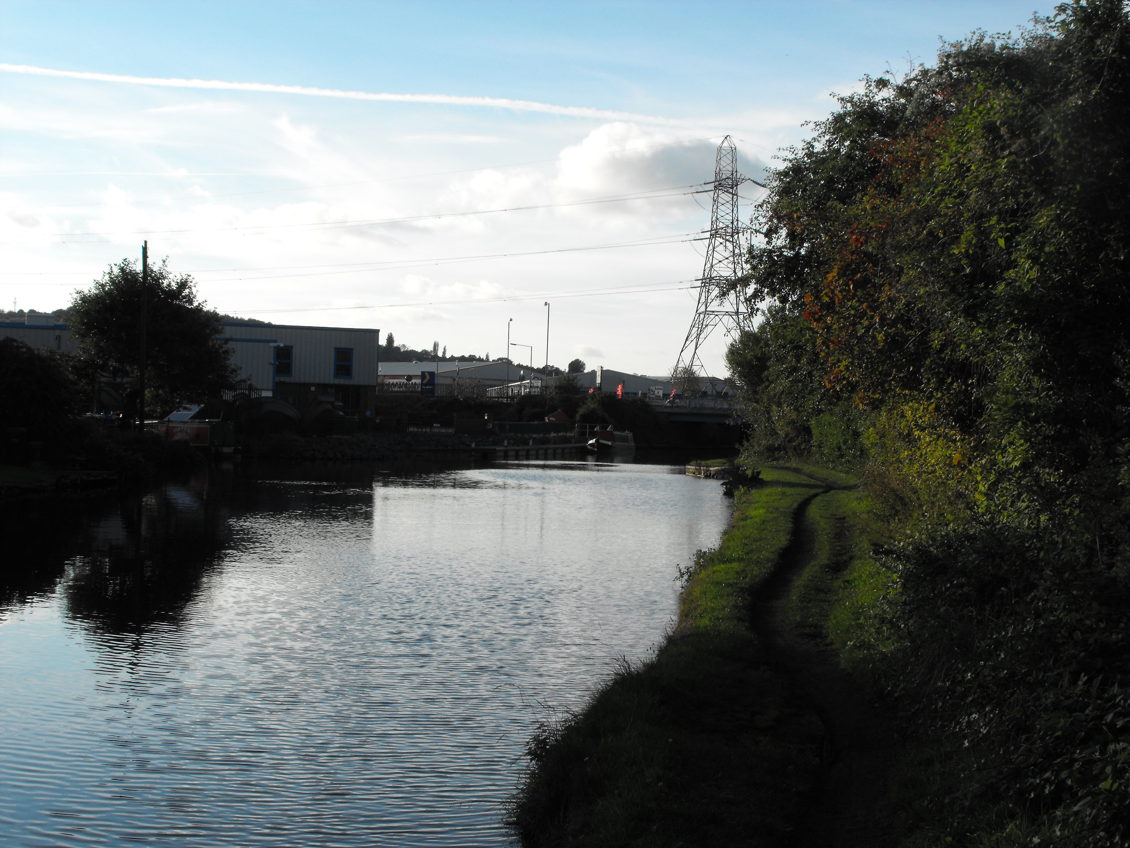
In the heart of Oldbury, bisected by The Old mainline canal. Numerous boats are moored along what remains of The Churchbridge arm. Whimsey bridge at the A4034 Churchbridge – now actually two separate bridges loom ahead with the pylon pointing the way.

The remaining foot of the Churchbridge arm. An aquatics centre has replaced an area once populated by boatcraft. The firm T and S Elements were based in this area before it became Allen’s boat yard. This too has now gone. The area is sometimes referred to as “Valencia Wharf” and now provides space for lorries instead of boats.


Underneath Whimsey Bridge, the next structure of importance High Bridge at Rounds Green Road.

Canal bridges along the BCN frequently place a date on their construction. This one clearly shows that the High bridge was upgraded some years after the Matty boats would have passed underneath, as shown in Roy Martin’s picture taken in 1972.

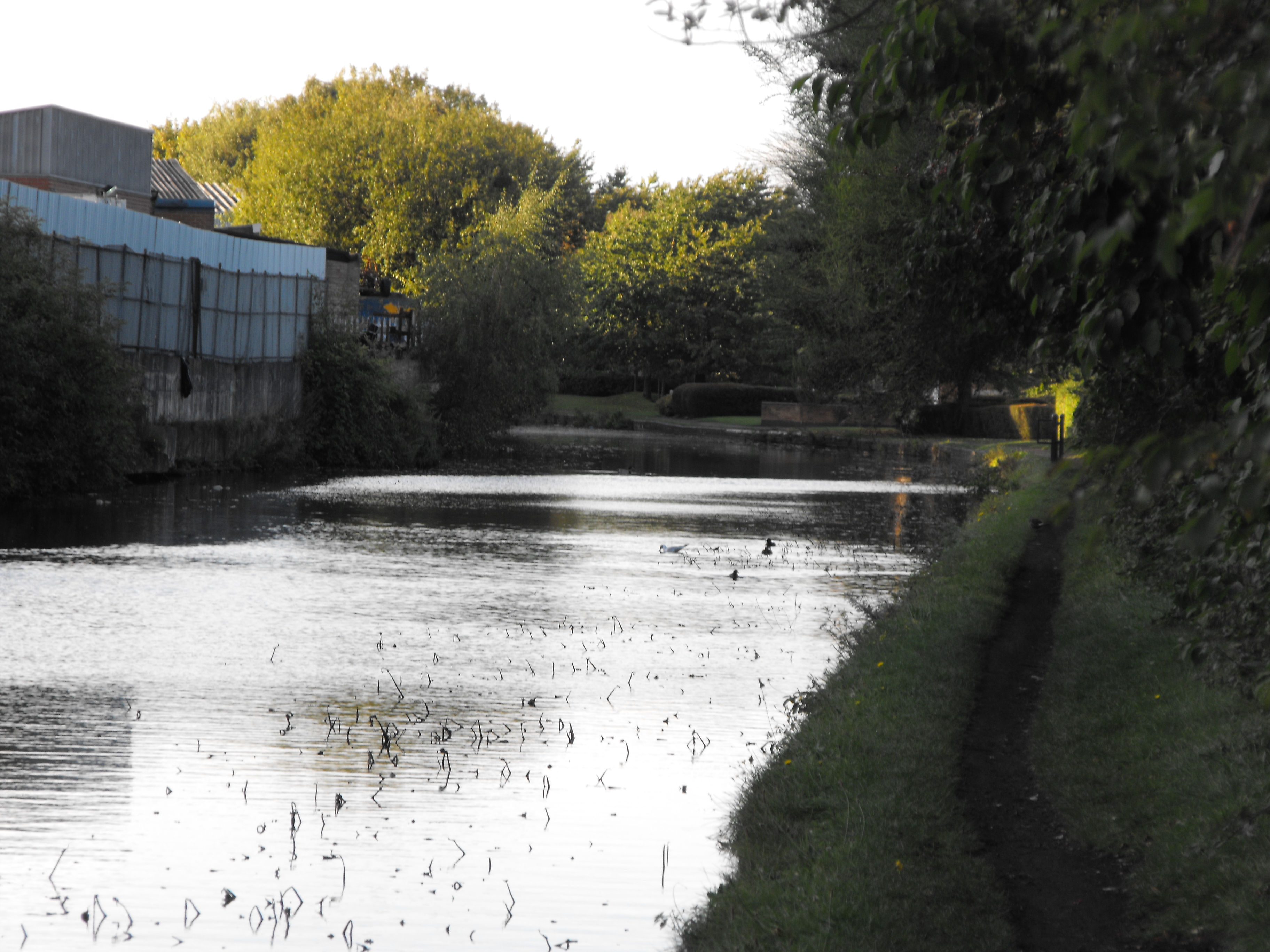
An unusually long straight stretch of Old Mainline canal opens up with a mixture of industrial units and firms lining either side of the canal including the Oldbury Green retail park. The former Oldbury loop branched off from the old mainline but there is nothing left to show of it now having been infilled by the 1960’s.
Eventually on the towpath side, we reach a housing estate at the aptly named Waterways Drive.
The new housing development looking towards Brades Bridge which meets Brades Road and Brades Rise. In the distance the Brades Hall locks.

Incredible to believe that this structure originated in 1855- just four years after the official commencement of the Albright and Wilson partnership. One can only speculate how many boats (and ducks) have passed beneath it in the last 158 years. The Brades Iron and Steel works of William Hunt and Sons, which made edge tools, are long gone.

At this point the toxic trail driver in the boat must have been slowing down ready to turn right.

A glimpse of the former Albright and Wilson/Rhodia Gower Tip. Now overgrown and forgotten. Just the way that chemical companies and new housing developers like it.
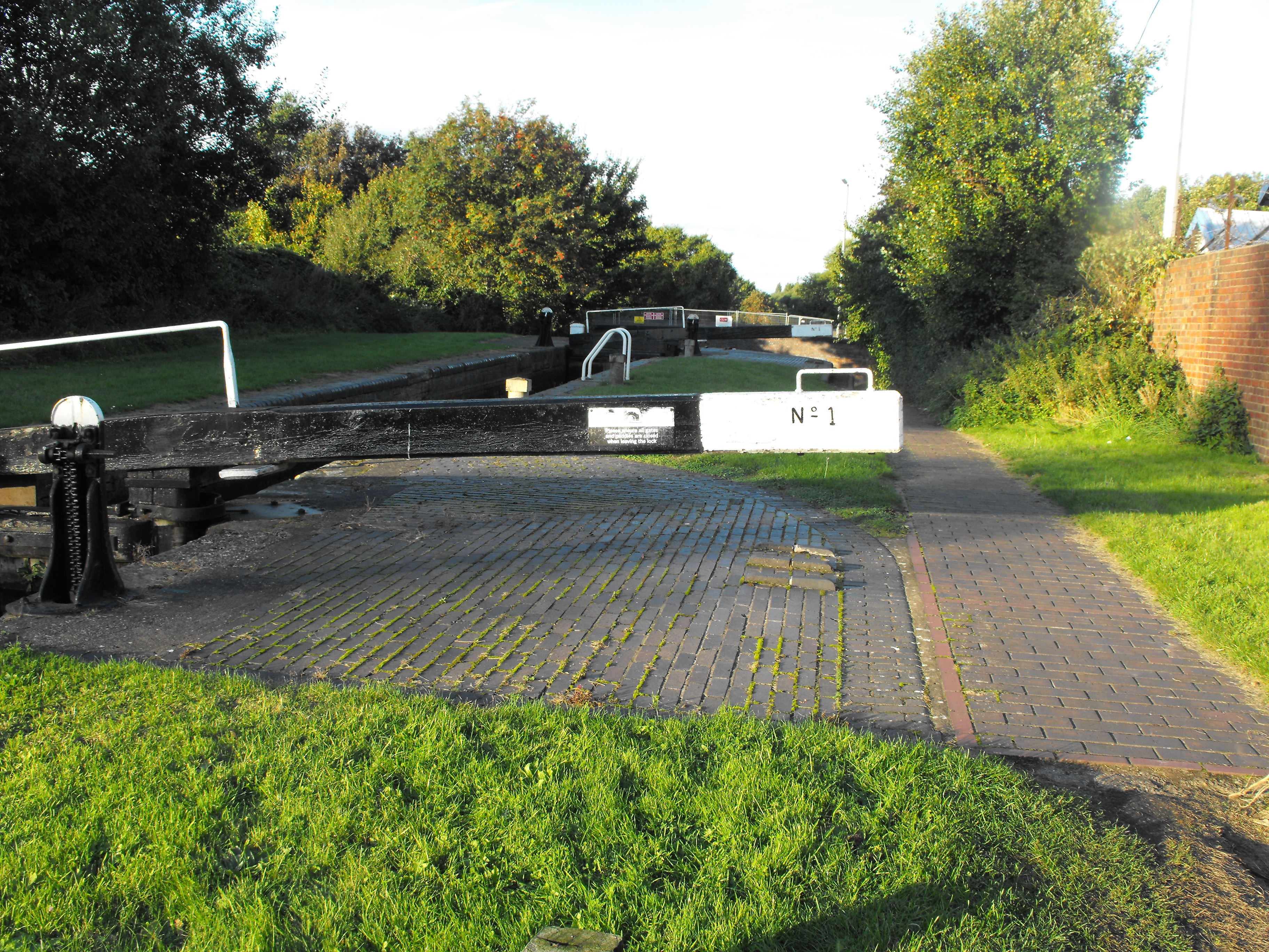
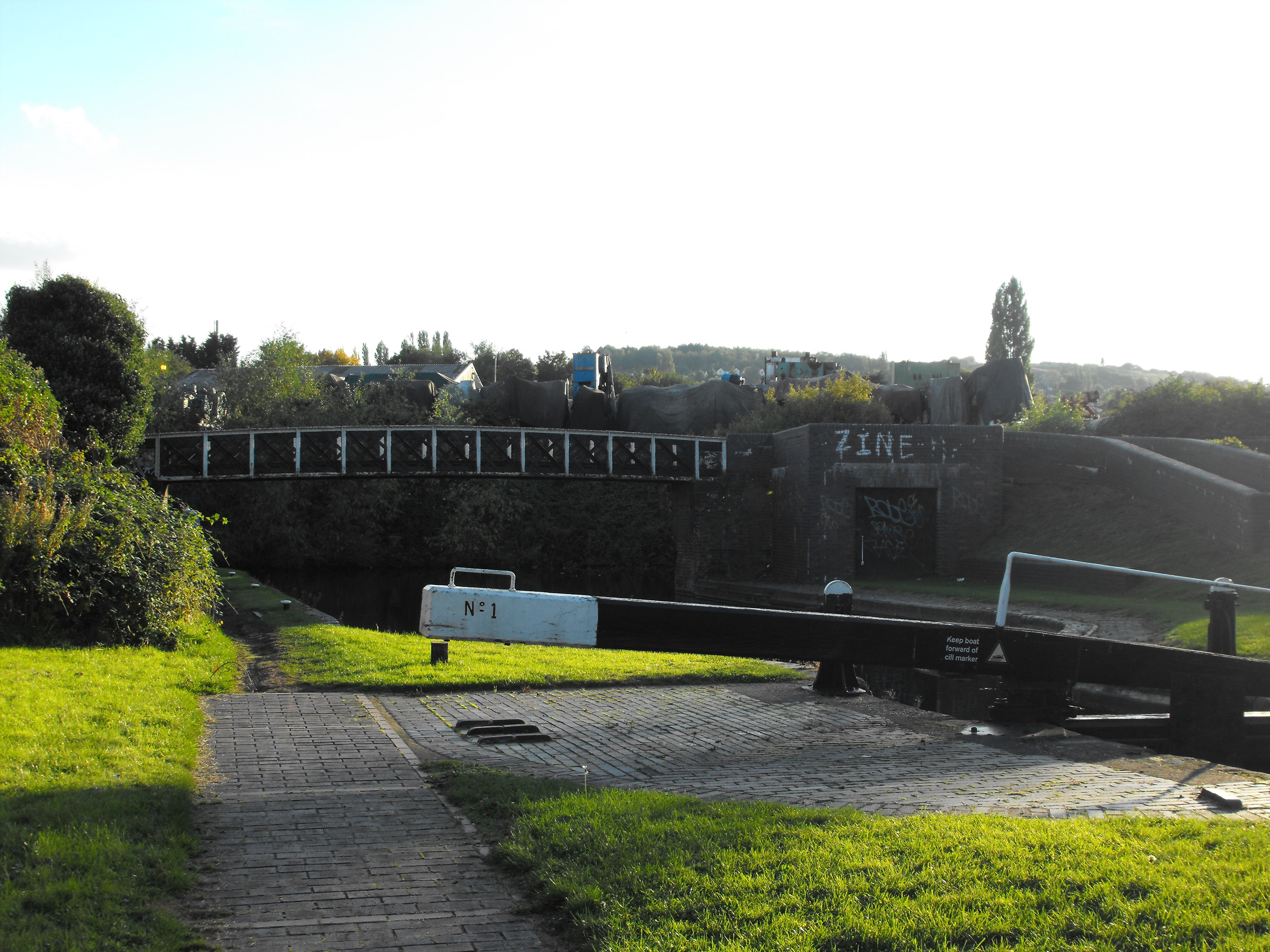
Lock number one of The Brades Lock staircase.
At Brade’s Hall Junction, the Old Main Line is connected to Telford’s New Main Line by the Gower Branch canal . In this “staircase lock” ,one lock passes water directly into the next, without an intervening pound. The top two dating from 1836 are Grade two listed.
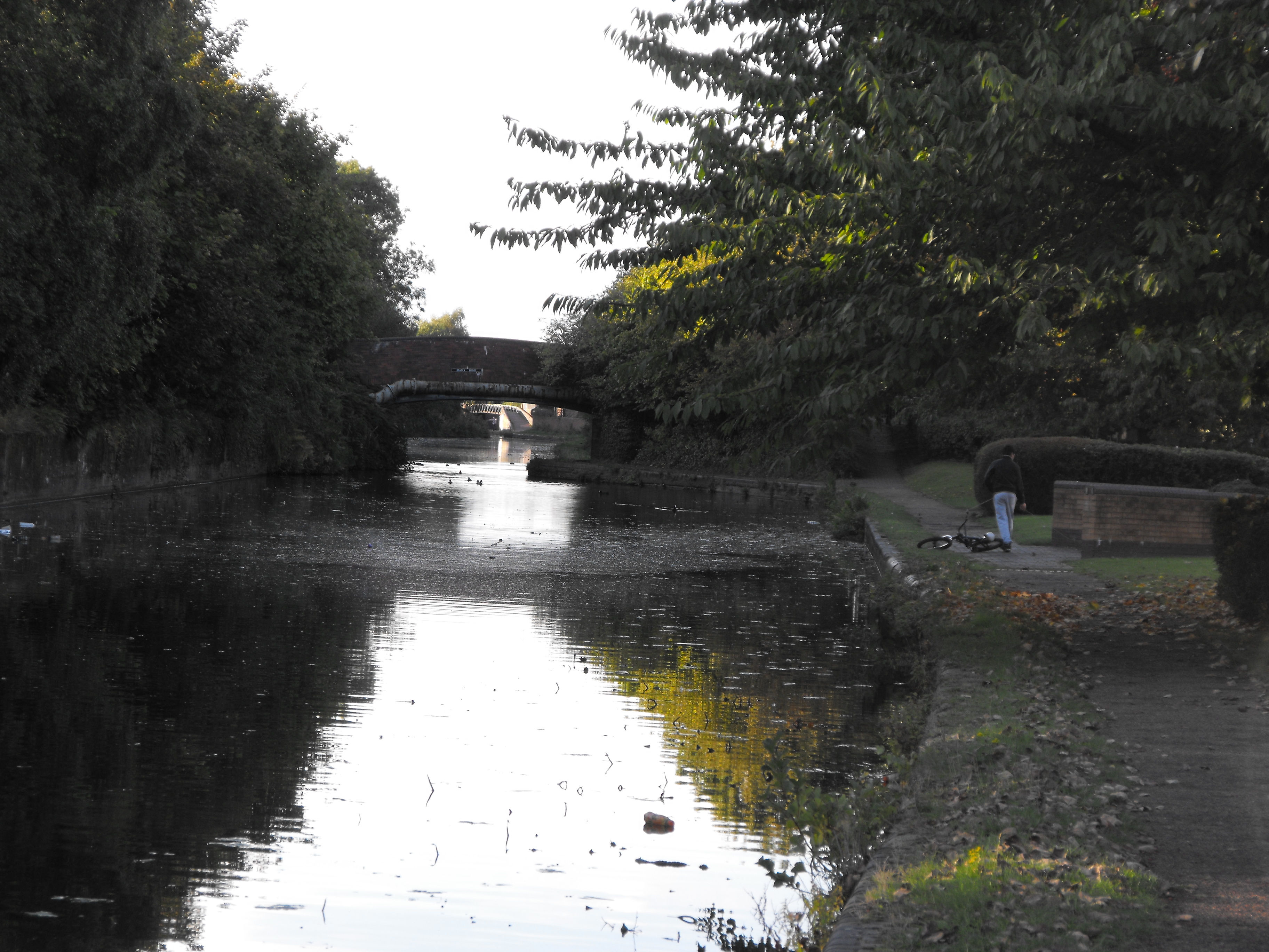
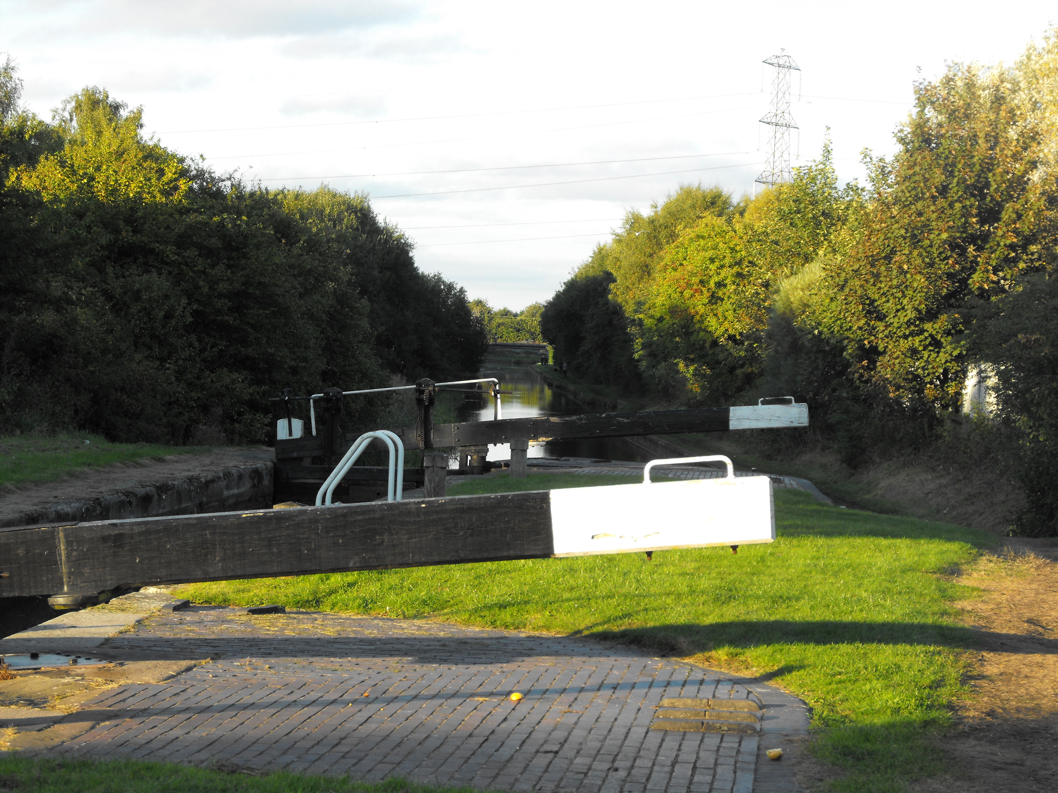
Looking back from the top Brades Lock. This is a popular fishing spot, evidenced by the frequent rubbish found left behind.

The second lock and Brades Hall Bridge which have benefitted from a recent new coat of paint.

A British Waterways sign still looms above the locks- now a memory replaced by The Canal and Rivers Trust. At the time of this visit, works on the road bridge were taking place causing significant tailbacks in both directions of the A457 Dudley Road East.

Low headroom for the boater evidenced on this rusty old girder, but even lower for those on a bike- 5′ 5”. For those thinking of riding a bike down the steps/ramp you need to dismount here or get a headache pretty fast!

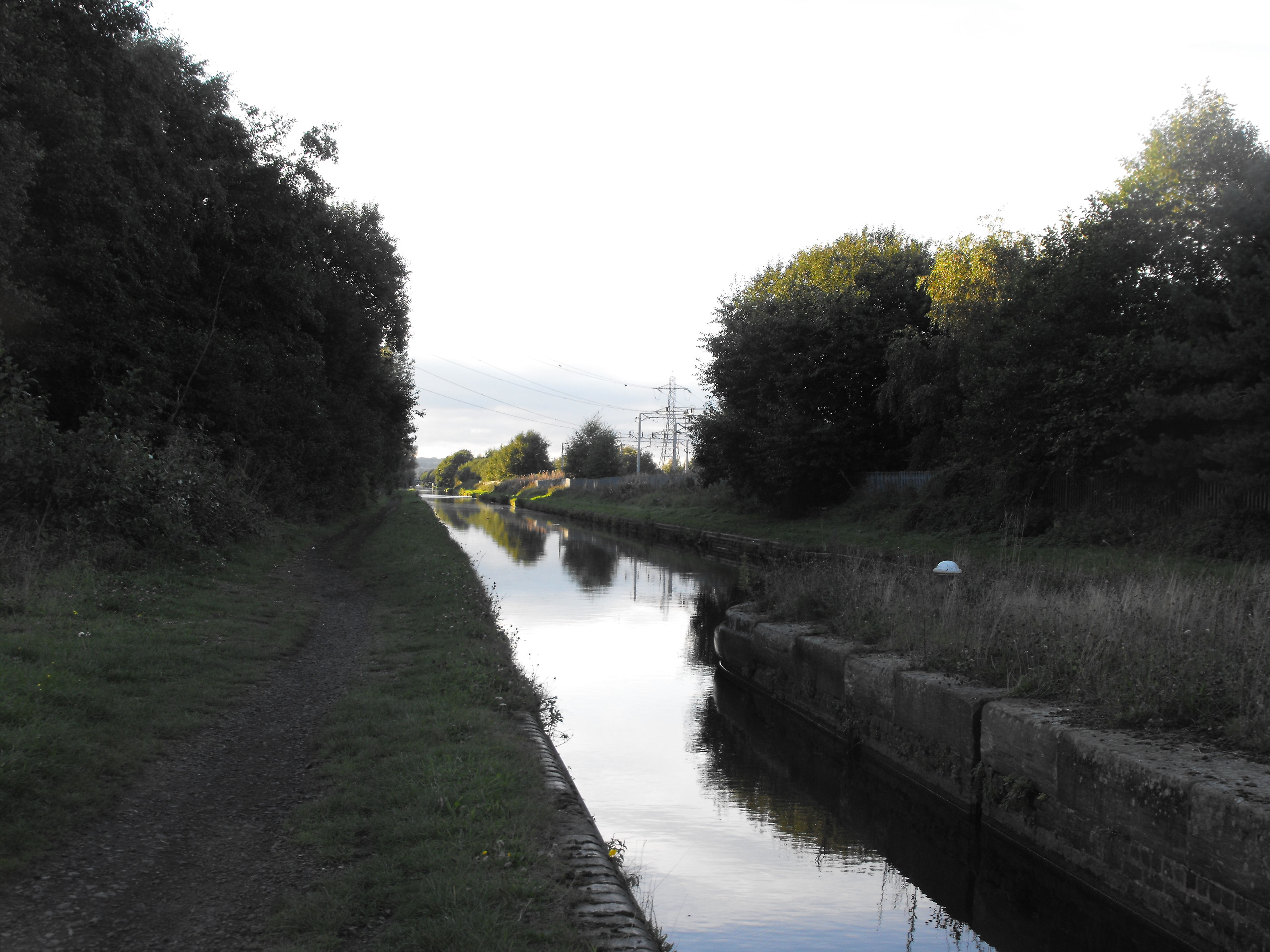
A long lock pound, sometimes drained, the water is often gin clear allowing us a glimpse of trolleys and silt below- but not what lies beneath that.
The final lock, with the Gower Branch stretch in the distance. A large area to the right is now home to the largest Hindu Temple in Europe. With this Green gateway who would think that this is the urban West Midlands?
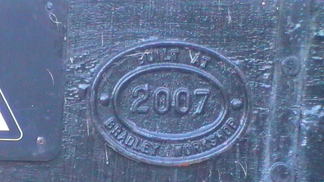
This lock gate confirms its recent origin at the Bradley yard in Bilston.

The Albion junction where the Gower Branch meets the New Mainline. This left turn heads towards the lagoon via this long straight path which continues unbroken to the Factory Locks at Tipton.

Another 1855 bridge.
The Horseley Iron Works built bridge. A world famous Tipton firm.

Where am yo a goin ah kid?
7.5 miles to Wolverhampton and 5.5 miles to Birmingham. Who could get lost?

Crossing the junction bridge that would have seen the Matty Boats on the final leg of the journey. Ahead is a narrow pass at the island in the middle of the cut known as “The Dunkirk Stop”, where tolls would have formerly been collected. The Dunkirk Branch canal ran abandoned in 1953 ran on from the junction. A street is now all that remains of the name. I wonder how much waste got spilt in this area?
Passing the dunkirk stop
The railway line on the right also runs parallel with the canal towards Tipton.

Looking towards the Rattlechain Brickworks Bridge. This served the brickworks having a wide angled basin. A rickety set of planks can be walked or detoured by going left whereby you encounter a dirty greening pile of foundry sand that now covers every trace of where the brickworks stood. A brief remnant of the basin remains, but now covered with vegetation.


on the rattlechain brickworks bridge.
From here, the visible razor wire fencing of rattlechain lagoon is visible to the top left. At this point the boaters would have been slowing down and thinking of discharging duties. At this point in 2013 the batteries in my camera ran out- who needs technology? Almost fatefully my recreation of the journey had come to an end. Nothing now remains of the pumphouse or pump that Enoch Clowes et al operated.
I stand on the same canal towpath that served the Barnett’s brickworks, that breached in 1899, that allowed toxic waste to be carried and dumped because of industries idleness and wonder what the next 50 years will bring. Almost certainly and depressingly it will be houses. Another generation of people who know nothing of the areas hidden menaces, and attracted by a piece of greenery and open water that attracts wildlife like a Venus flytrap attracts new flesh.
Some predictions for those in the future who may read this or take up the pen or whatever is used then. The canal will still be here, though I won’t be. The bridges may be renamed after some none deserving local politicians, or worse continue the local estate theme of former prime Ministers – add “Thatcher Drive”, “Major Street” or even worse still “Blair Rise” to the likes of McDonald Close , Callaghan and Wilson Drives. And the rattlechain lagoon? The toxic waste from the toxic trail still buried, white phosphorus waiting to be unleashed.
COMMENTS

“Dear Blogger,
This is a great site and I have only just come across this. Great research on many levels. I cannot believe this issue has been rumbling on now for a decade. My mother and father live at Horseley Heath; I grew up in Horseley Heath, so I know the Rattlechain area well. I used to go looking for newts (with a net and bucket) close by along a small basin on the canal between the junction of Birmingham/Dudley canal branch and Dudley Port. Not far away and possibly the one on the photo. I used to walk to Albion along the canal as I was interested in railways as a young lad/teenager and often spent time nearby.
I’ve just spoken to my father. He grew up in Greets Green and as lived in Horseley Heath since 1966. He is a canal enthusiast as well as a railway one; he has photos of the Alfred Matty boats and he has watched them taking phosphorus to the site. He says there was “a sweet smell” around the boats and he observed that the water at the clay pit was stained “a duck egg blue”. He also says there was a visible mist emitted from the boats.
He also recalls kids throwing bricks into the clay pit pond and the fact nothing lived in it. I remember the inconsistency of wildlife in the Brum-Wolves canal too. Many of the fish seemed to have fungus on them and were dying. I never took fish out of the canal at all. I was surprised the newts did well. I do recall that the entire length of the canal through the Tipton area was dredged and drained in the mid-80s when I was at school. I used to walk the canal to the Alexandra High School Annexe in Park Lane, and remember the fish being caught by British Waterways workers and I think some were put into the pool in Victoria Park.
Anyway, this is fairly shocking considering Sandwell Council are smelling the filthy lucre on this site. I do recommend contacting the Sandwell Green Party. It probably is time that the Labour Group were challenged on this issue. They do not have any Councillors of course, but they can assist. I wish you the best of luck in the future and will be looking over this issue in the coming months/years. I also hope to walk the area fairly soon.”
![]()
“PS- I worked at SGS on the Tividale end of Johns Lane from 1990-93. I often walked home via Johns Lane.”

“In reply to Mark Wilson.
Thanks for your kind words and story Mark. Unfortunately this has been going on for decades, and the issue is now made more serious by Sandwell council and others believing it is a good idea to build houses around a still unremediated toxic lagoon. The white phosphorus is still there and visibly producing phosphine gas- always associated with white phosphorus contaminated sites, like those in the US where superfund sites paid for certain “clean ups”- yet none of these had houses right on their perimeter.”
3 Responses to Toxic trail revisited